Village Assessment Survey Report

Oct 19 2023
- Mobility Tracking
- Site Assessment
KEY FINDINGS
1. HOUSING AND LAND CHALLENGES
Many bomas face issues related to housing, land demarcation, and property ownership, with some areas lacking demarcated settlement areas and others experiencing disputes over land boundaries, ownership and illegal occupancy.
2. EDUCATION ACCESS AND QUALITY
Challenges in the education sector include insufficient school facilities, staffing shortages, and high school fees, leading to dropout rates and limited access to quality education, particularly in government schools.
3. WATER, SANITATION, AND HYGIENE (WASH)
Insufficient water points, sanitation facilities, and hygiene resources contribute to health risks and discomfort within communities. Repairing and expanding water infrastructure and promoting sanitation practices are crucial for improving public health outcomes.
4. LIVELIHOOD OPPORTUNITIES
Limited livelihood opportunities exacerbate poverty and economic insecurity, highlighting the need for vocational training, business support, and agricultural assistance to empower community members and improve their economic prospects.
5. HEALTHCARE SERVICEGAPS
Healthcare services are inadequate, with shortages of medical supplies, personnel, and operational hours reported. Improving access to healthcare, especially during emergencies and at night, is essential to address community health needs effectively.
6. COMMUNITY INFRASTRUCTURE NEEDS
Inadequate community infrastructure, such as community centers and sports facilities, hinders social cohesion and recreational opportunities. Investing in the construction and maintenance of these facilities can enhance community well-being and promote social integration.
Oct 03 2023
- Mobility Tracking
- Site Assessment
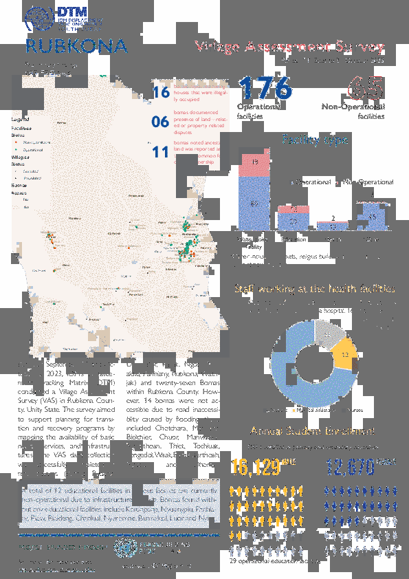
The data collection took place from September 14th, 2023, to October 3rd, 2023, covering a period of twenty days. The Displacement Tracking Matrix (DTM), a unit of the International Organization for Migration (IOM), conducted a 20-day Village Assessment Survey (VAS) in Rubkona County to assess transition and recovery needs. The survey focused on 09 Payam and 27 bomas accessible, as rainy season and flood limited access to some of the areas.
Of the 76 settlements assessed, 12 were found deserted while 64 remained populated. The survey meticulously mapped 240 facilities, 76 settlements, and 2 livelihood areas across the surveyed bomas. This includes 6 settlements in 6 bomas not assessed due to flooding. Among the 76-settlement identified, there are 37 neighborhoods, 30 permanent villages, 7 IDP sites and 2 temporary sites. The team managed to map 2 livelihood areas categorized into fishery grounds.
KEY FINDINGS
The assessment reveals a substantial number of destroyed or abandoned buildings, emphasizing the pressing need for housing reconstruction initiatives to address the housing crisis in the county.
Many areas within Rubkona County lack access to essential services such as education, healthcare, and markets, indicating a need for targeted interventions to improve service provision and overall community well-being.
In 67% of bomas, the fear of disasters, such as flooding, poses a substantial challenge for peaceful return, emphasizing the impact of environmental factors on human settlements.
A prevalent issue in multiple bomas across Rubkona County is the presence of individuals living on land/property without paying rent or obtaining permission from the owners, with 57% of bomas reporting such instances.
Most residential structures in Rubkona County lack permanency, characterized by the prevalence of temporary shelters such as tents and tukuls. These constructions are primarily composed of mud walls and thatched roofing, indicating a deficiency in durable and lasting housing infrastructure.
Critical need for improvements in school infrastructure, including insecure buildings, classroom shortages, insufficient furniture, and inadequate water and sanitation facilities, to create a conducive learning environment.
Urgent need for renovations, upgrades, and construction of permanent structures in healthcare facilities to ensure a safe environment for patients and healthcare workers.
The pressing need to rehabilitate non-operational boreholes to ensure a reliable water supply. the lack of water user committees in certain bomas inhibits local management of water resources.
Oct 19 2023
- Mobility Tracking
- Site Assessment
Between 1 September and 13 October 2023, the IOM's Displacement Tracking Matrix (DTM) carried out a Village Assessment Survey (VAS) in Juba County, Central Equatoria, with the goal of aiding planning for transition and recovery programs by mapping the availability of basic needs, services and infrastructure. The VAS data collection completed in sixteen payams and forty-nine bomas within Juba County. However, forty-one bomas were not assessed due to various factors including the lack of boma chief administrations, insecurity related to land grabbing (in Jebel Lodu and Tendere bomas), poor road conditions (in Kansuk boma), insecurity along a specific road (in Wonduruba payam), and discrepancies in boma names (in Mogiri). Additionally, some areas were not covered because residents had moved due to conflicts between farmers and cattle keepers, and one boma remained unassessed as it is currently having presence of soldiers.

Oct 19 2023
- Mobility Tracking
- Site Assessment
Between 23 September and 19 October 2023, IOM's Displacement Tracking Matrix (DTM) conducted a Village Assessment Survey (VAS) in Wau County, Western Bahr el Ghazal. The Survey aims to support planning for transition and recovery programs by mapping the availability of basic needs, services, and infrastructure. The VAS data collection was successfully completed in five payams (Bagari, Beselia, Kpaile, Wau North, and Wau South) and forty-two bomas within Wau County. However, three bomas including Hai Jadid, Gittan and Rafili wer not assessed due to either being deserted or poor road conditions.
Oct 03 2023
- Mobility Tracking
- Site Assessment
- Village Assessment
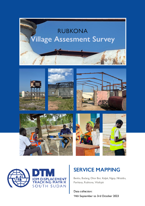
Between 14 September and 3 October 2023, IOM's Displacement Tracking Matrix (DTM) conducted a Village Assessment Survey (VAS) in Rubkona County, Unity State. The survey aims to support planning for transition and recovery programs by mapping the availability of basic needs, services, and infrastructure. The VAS data collection was successfully completed in nine payams (Bentiu, Budang, Dhor Bor, Kaljak, Ngop, Nhialdiu, Panhiany, Rubkona, and Wathjak) and twenty-seven bomas within Rubkona County. However, 14 bomas were not accessible due to road inaccessibility caused by flooding, these included Chotchara, Mathiang, Bielchier, Chuor, Manwalbar, Ngopthoan, Thiet, Tochluak, Tongedol, Waak, Bany, Kuerthoah, Ngaplel, and Dhorbor
Mar 27 2023
- Other
- Survey
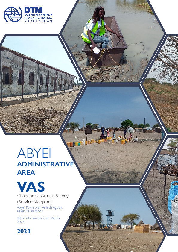
IOM’s Displacement Tracking Matrix (DTM) conducted the Village Assessment Survey (VAS) to facilitate planning for transition and recovery programs. Its main objectives are to map the availability of basic needs, services, and infrastructure and to identify priority areas for intervention within selected counties in South Sudan.
This Abyei Administrative Area Village Assessment Survey covers a period from 28 February to 27 March 2023. The survey team mapped 393 facilities, encompassing 19 administrative buildings, 9 markets, 28 religious structures, 3 bus stations, and 264 water points. Notably, educational and healthcare facilities were identified as well, with 49 education facilities and 24 health facilities marked.
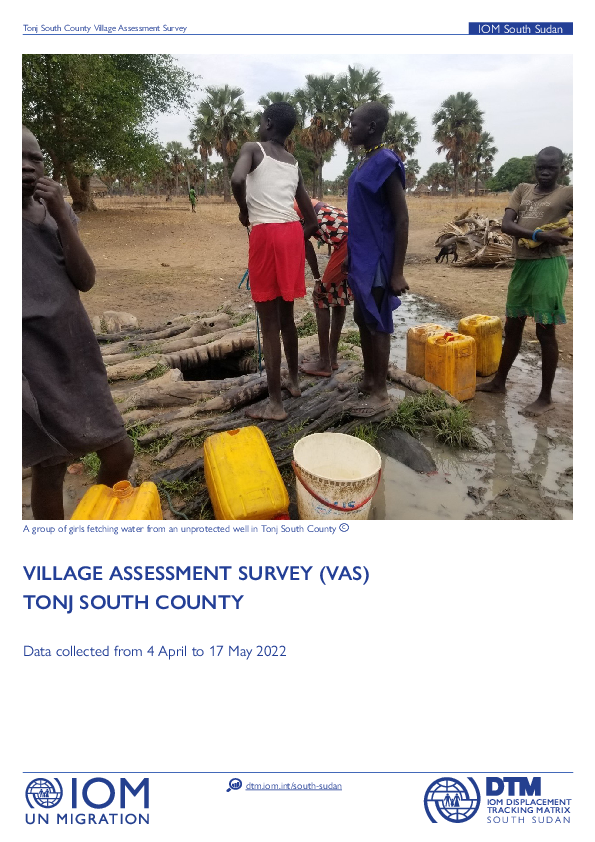
May 17 2022
- Mobility Tracking
- Site Assessment
This Tonj South Village Assessment Survey covers a period from 4 April to 17 May 2022. Notably, it was found that 94% of administrative buildings, 90% of religious buildings, and 88% water points are functional. On the other hand, all of the assessed market facilities were found to be functional.

Apr 30 2021
- Mobility Tracking
- Site Assessment
This Aweil South Village Assessment Survey covers a period from 26 March to 30 April 2021. Notably, it was found that 89% of education facilities are functional, and 72% of water points are functional. On the other hand, administrative buildings, health facilities, markets, religious facilities, and transport networks were all found to be functional.

Apr 12 2021
- Site Assessment
- Other
- Survey
IOM’s Displacement Tracking Matrix (DTM) conducted the Village Assessment Survey (VAS) to facilitate planning for transition and recovery programs. Its main objectives are to map the availability of basic needs, services, infrastructure and to identify priority areas for intervention within selected counties in South Sudan. The assessment is funded by the Reconciliation, Stabilization and Resilience Trust Fund area based programming for Jonglei and Greater Pibor Administrative Area. Data collection and analysis was conducted as part of joint IOM and UNICEF-led program on strengthening education programs and infrastructure in targeted counties.
Data was collected between March and April 2021, with previously inaccessible facilities and settlements in Akobo assessed
in May and June 2021. DTM assessed the counties of Akobo and Pibor in Jonglei state, covering 25 bomas in seven payams (83.3% coverage) and 34 bomas in four payams (54.8% coverage), respectively. Five bomas in Akobo could not be assessed due to insecurity and road inaccessibility. In Pibor, five bomas could not be assessed due to road inaccessibility.
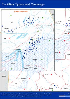
Nov 30 2019
- Mobility Tracking
- Site Assessment
This atlas contains 17 individual maps as part of the Wau, Rubkona And Bor South Village Assessment Survey (August - November 2019). DTM mapped the presence and quality of available facilities, infrastructure and services:
- Facilities Types and Coverage
- Education Facilities by Functionality
- School Curriculum
- Healthcare Facilities by Functionality
- Improved Water Point Facilities
- Access to Water and Related Conflict
- Access to Water Sources
- Most Common Forms of Sanitation Practices
- Most Common Shelter Types
- Major Livelihood Practices
- Top Three Livelihood Shocks
- Land Ownerships and Land Allocations to returnees
- Challenges that Affect Farming
- Access to Major Markets
- External Threats, Violations and Risks
- Internal Threats, Violations and Risks
- Presence of Mines and Demining Activities

DTM Global Survey 2023
The Displacement Tracking Matrix (DTM) Global Survey 2023 is an annual stocktaking exercise which aims to present IOM DTM's operations and activities transparently. The Global Survey focuses on operations active from January 1 to December 31, 2023, with data collection occurring from February to April 2024.