-
Countries
-
Data and Analysis
-
Special Focus
-
Crisis Responses

Contact
DTM Somalia, IOMSomaliaDTM@iom.int
Language
English
Location
Somalia
Period Covered
Jan 01 2017
Dec 31 2021
Activity
- Other
- Mobility Tracking
- Baseline Assessment
On 23 November 2021, the Federal Government of Somalia declared a state of emergency due to drought. In order to support operational planning, DTM Somalia has conducted an analysis of previous drought-related data from 2017 to better understand potential hotspots for displacement and projections of internal displacement movements in the next six months. DTM Somalia has produced projections for two scenarios based on the current drought severity:
• Scenario 1 estimates that 1,415,000 people may be displaced by drought in the coming 6 months
• Scenario 2 estimates that 1,036,000 may be displaced by drought in the coming 6 months
The methodology relies on FAO SWALIM drought severity maps and DTM Somalia ETT and Baseline two data.
Analysis into the following key regions has been conducted to provide an overview of displacement patterns and rural settlements proximity to urban settlements: BAY, BANADIR, GEDO, HIRAAN, BARI, NUGAAL, MUDUG, GALGADUUG, LOWER JUBA, LOWER SHABELLE.
Contact
DTM Sudan, DTMSudan@iom.int
Language
English
Location
Sudan
Snapshot Date
Dec 19 2021
Activity
- Mobility Tracking
- Baseline Assessment
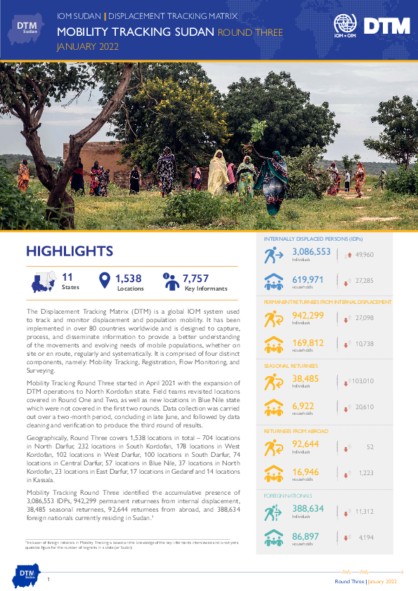
Mobility Tracking Round Three started in April 2021 with the expansion of DTM operations to North Kordofan state. Field teams revisited locations covered in Round One and Two, as well as new locations in Blue Nile state which were not covered in the previous rounds. In Round Three, enumerators visited locations across a total of 11 states.
Data collection was carried out over a two-month period, concluding in late June, and followed by data cleaning and verification to produce the third round of results. Key informants included community leaders, government representatives, NGO and humanitarian aid workers, religious leaders and IDP representatives.
Geographically, Round Three covers 1,538 locations in total – 704 locations in North Darfur, 232 locations in South Kordofan, 178 locations in West Kordofan, 102 locations in West Darfur, 100 locations in South Darfur, 74 locations in Central Darfur, 57 locations in Blue Nile, 37 locations in North Kordofan, 23 locations in East Darfur, 17 locations in Gedaref and 14 locations in Kassala.
Mobility Tracking Round Three identified the accumulative presence of 3,086,553 IDPs, 942,299 permanent returnees from internal displacement, 38,485 seasonal returnees, 92,644 returnees from abroad, and 388,634 foreign nationals currently residing in Sudan.
Contact
DTM Chad, dtmtchad@iom.int
Language
English
Location
Chad
Snapshot Date
Jan 13 2022
Activity
- Event Tracking
- Mobility Tracking
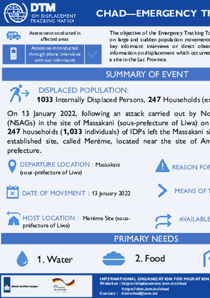
The objective of the Emergency Tracking Tool (ETT) is to collect information on large and sudden population movements. Information is collected through key informant interviews or direct observation. This dashboard provides information on displacement which occurred on 13 January 2022 in Massakani, a site in the Lac Province. On 13 January 2022, following an attack carried out by Non-State Armed Groups (NSAGs) in Massakani (sous-prefecture of Liwa) on the night of 12 January, 247 households (1,033 individuals) of IDPs left the site of Massakani and fled to the newly established site, called Merème, located near the site of Amma, in the same sous-prefecture.

Contact
DTM Tchad, dtmtchad@iom.int
Language
French
Location
Chad
Snapshot Date
Jan 13 2022
Activity
- Event Tracking
- Mobility Tracking
Le suivi des urgences a pour but de recueillir des informations sur les mouvements importants et soudains de populations. Les informations sont collectées à travers des entretiens avec des informateurs clés ou des observations directes. Ce tableau de bord présente des informations sur un mouvement de personnes survenu le 13 janvier 2022 à Massakani, un site de la province du Lac. Le 13 janvier 2022, suite à une attaque survenue dans la nuit du 12 janvier par des groupes armés non étatiques (GANE) dans Massakani (sous-préfecture de Liwa), 247 ménages (1033 individus) constitués des PDI ont quitté le site de Massakani et se sont installés dans un nouveau site nommé « Merème, » situé non loin du site d’Amma, dans la sous-préfecture de Liwa.
