-
Countries
-
Data and Analysis
-
Special Focus
-
Crisis Responses
Contact
DTM Chad, dtmtchad@iom.int
Language
French
Location
Chad
Period Covered
Nov 01 2022
Nov 30 2022
Activity
- Mobility Tracking
- Event Tracking
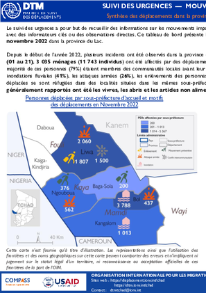
Le suivi des urgences a pour but de recueillir des informations sur les mouvements importants et soudains de populations. Les informations sont collectées à travers des entretiens avec des informateurs clés ou des observations directes. Ce tableau de bord présente les informations sur les mouvements des personnes survenus dans la période du 01 au 21 novembre 2022 dans la province du Lac.
Depuis le début de l’année 2022, plusieurs incidents ont été observés dans la province du Lac entraînant un grand nombre de déplacements. Durant le mois de novembre 2022 (01 au 21), 3 035 ménages (11 743 individus) ont été affectés par des déplacements, soit 65 pour cent de moins comparé à la période du 07 au 31 octobre 2022. Ainsi, la majorité de ces personnes (79%) étaient membres des communautés locales avant leur déplacement. Il est à souligner que ces déplacements ont été principalement causés par les inondations fluviales (41%), les attaques armées (26%), les enlèvements des personnes (15%) et les conflits intercommunautaires (13%). En effet, 67 pour cent des personnes déplacées se sont réfugiées dans des localités situées dans les mêmes sous-préfectures que leurs lieux des provenances (voir le tableau 1). Les besoins immédiats généralement rapportés ont été les vivres, les abris et les articles non alimentaires.

Contact
DTM Burundi, DTMBurundi@iom.int
Language
English
Location
Burundi
Period Covered
Jan 29 2022
Feb 05 2023
Activity
- Mobility Tracking
- Event Tracking
Entre le 29 Janvier 2022 et le 5 Février 2023, la DTM a identifié 28 473 personnes affectées dont 1 029 personnes déplacées. Les types d'urgences reportées comprennent Grêle, Vents violents, Pluies torrentielles et Inondations.
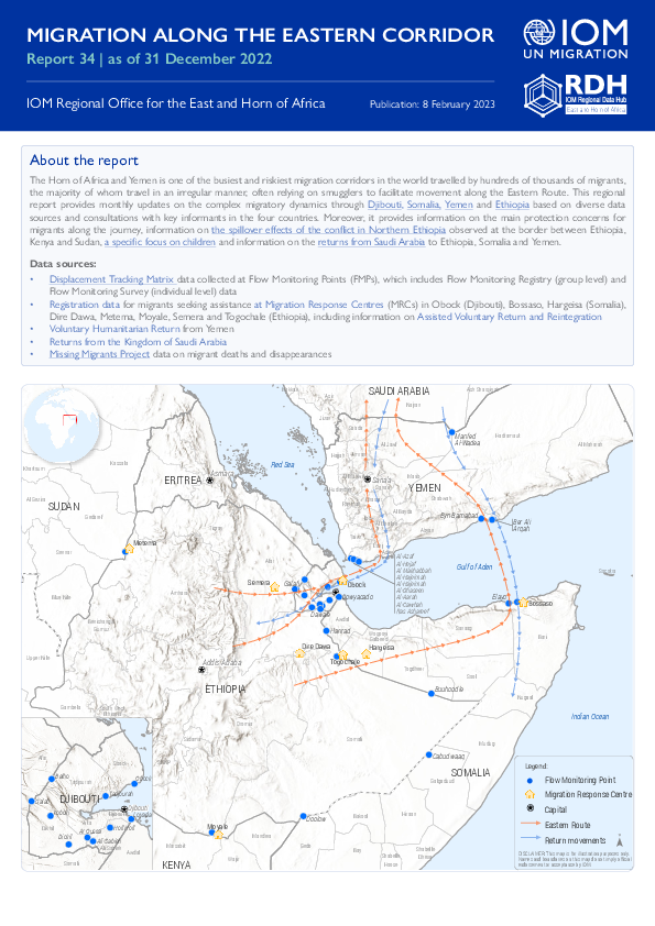
The Horn of Africa and Yemen is one of the busiest and riskiest migration corridors in the world travelled by hundreds of thousands of migrants, the majority of whom travel in an irregular manner, often relying on smugglers to facilitate movement along the Eastern Route. This regional report provides monthly updates on the complex migratory dynamics through Djibouti, Somalia, Yemen and Ethiopia based on diverse data sources and consultations with key informants in the four countries. Moreover, it provides information on the main protection concerns for migrants along the journey, information on the spillover effects of the conflict in Northern Ethiopia observed at the border between Ethiopia, Kenya and Sudan, a specific focus on children and information on the returns from Saudi Arabia to Ethiopia, Somalia and Yemen.

Contact
DTM Chad, dtmtchad@iom.int
Language
English
Location
Chad
Period Covered
Nov 01 2022
Nov 30 2022
Activity
- Mobility Tracking
- Event Tracking
The purpose of the Emergency Tracking Tool (ETT) is to collect information on large and sudden population movements as well as on security and climate emergencies. This dashboard provides information on movements which occurred during the period from 01 to 21 November 2022, in Lac Province.
Since the beginning of 2022, several incidents have been observed in the Lake Province resulting in many displacements. During November 2022, 3,035 households (11,743 individuals) were affected by displacement, which is 65 percent less than the period from 7 to 31 October 2022. The majority of these persons (79%) were local communities before these new displacements. It should be noted that most displacements were mainly caused by river flooding (41%), armed attacks (26%), kidnapping (15%) and intercommunal conflicts (13%). Indeed, 67 percent of displaced individuals took refuge in localities situated in the same sous-préfectures as their locations of provenance (see Table 1). The most reported urgent needs were food, shelter and non-food items.
Contact
DTM Somalia, IOMSomaliaDTM@iom.int
Language
English
Location
Somalia
Period Covered
Jan 21 2023
Jan 25 2023
Activity
- Mobility Tracking
- Event Tracking
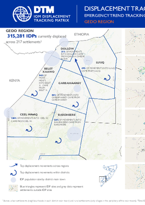
There are 315,281 individuals currently displaced by drought in Gedo region. Since round 46, an estimated 4,959 IDPs arrived at the assessed settlements.
Contact
DTM Nigeria, iomnigeriadtm@iom.int
Language
English
Location
Nigeria
Period Covered
Jul 01 2022
Sep 30 2022
Activity
- Mobility Tracking
- Event Tracking
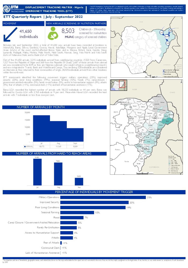
Between July and September 2022, a total of 41,650 new arrivals have been recorded at locations in Askira/Uba, Bama, Dikwa, Damboa, Gwoza, Hawul, Kala/Balge, Monguno and Ngala Local Government Areas (LGAs) of the most conflict-affected Borno State; and in Demsa, Fufore, Girei, Gombi, 13Hong, Lamurde, Madagali, Maiha, Michika, Mubi North, Mubi South, Numan, Song, Yola North and Yola South LGAs of Adamawa State; and in Bade LGA of Yobe State.
Out of the 41,650 arrivals, 3,215 individuals arrived from neighbouring countries (1,520 from Cameroon, 1,327 from the Republic of Niger and 368 from the Republic of Chad). 2,687 of these arrivals from abroad are now considered to be IDPs as they are Nigerian nationals who sought refuge in a neighbouring country and now integrated in transit, Banki and Waterboard Camps. The remaining 528 individuals are considered as returnees as they returned to their communities of origin. 38,435 individuals arrived from other locations within the north-east.
Contact
DTM Libya, DTMLibya@iom.int
Language
English
Location
Libya
Snapshot Date
Jan 31 2023
Activity
- Mobility Tracking
- Site Assessment
Detention Centre Profiling is a component of IOM Libya’s Displacement Matrix programme. It is a data oriented tool that routinely provides specific sex and age demographic data and key sectorial information on individuals held in Libya’s detention centres on the date of assessment.
Contact
iomnboim@iom.int
Language
English
Location
Kenya
Period Covered
Nov 21 2022
Dec 01 2022
Activity
- Mobility Tracking
- Baseline Assessment
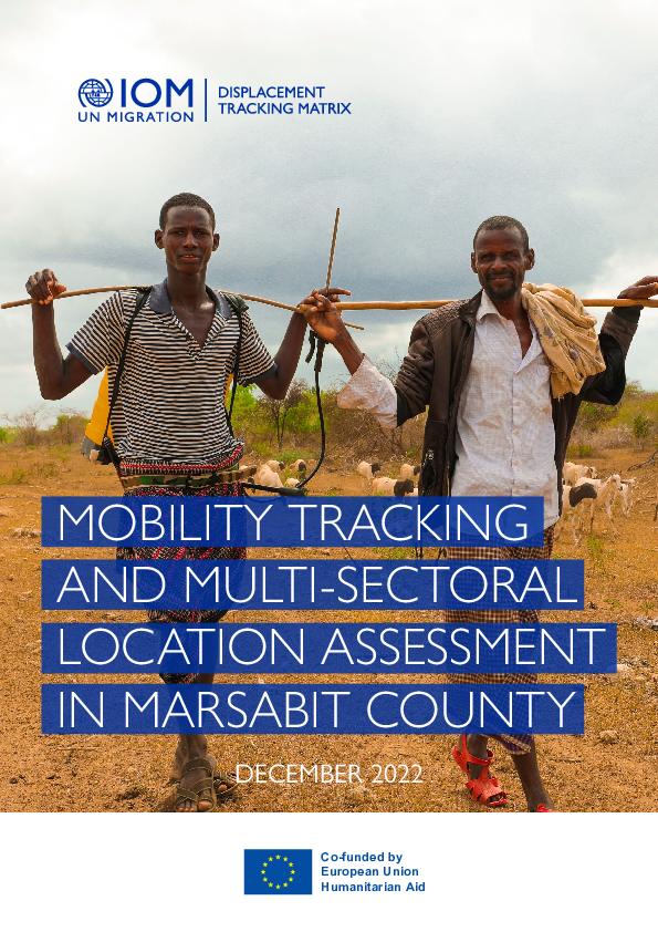
Marsabit County is the second largest county in Kenya covering 70,961.2 square kilometers(km)2, located
in the upper Northern region of Kenya. It has an international boundary with Ethiopia to the north,
borders Turkana County to the west, Samburu County to the south and Wajir and Isiolo counties to
the East7 and is among the 29 counties identified as ASAL areas. The county has nine sub-counties with
headquarters located at Marsabit Town. The population of Marsabit County is 459,785 individuals with its
main economic activity derived from pastoralism8. Due to the considerations arising from the land mass
and high population, four sub-counties are further divided into nine for the betterment and ease of the
service delivery.
