-
Countries
-
Data and Analysis
-
Special Focus
-
Crisis Responses
Contact
DTM Libya, DTMLibya@iom.int
Language
English
Location
Libya
Snapshot Date
Oct 31 2019
Activity
- Mobility Tracking
- Site Assessment
Detention Centre Profiling is a component of IOM Libya’s Displacement Matrix programme. It is a data-oriented tool that routinely provides specific sex and age demographic data and key sectorial information on individuals held in Libya’s detention Centres on the date of assessment.
Contact
DTM Libya, DTMLibya@iom.int
Language
English
Location
Libya
Snapshot Date
Sep 30 2018
Activity
- Mobility Tracking
- Site Assessment
Detention Centre Profiling is a component of IOM Libya’s Displacement Matrix programme. It is a data-oriented tool that routinely provides specific sex and age demographic data and key sectorial information on individuals held in Libya’s detention Centres on the date of assessment.
Contact
DTM Libya, DTMLibya@iom.int
Language
English
Location
Libya
Snapshot Date
Aug 31 2018
Activity
- Mobility Tracking
- Site Assessment
Detention Centre Profiling is a component of IOM Libya’s Displacement Matrix programme. It is a data-oriented tool that routinely provides specific sex and age demographic data and key sectorial information on individuals held in Libya’s detention Centres on the date of assessment.

Contact
DTM Nigeria, iomnigeriadtm@iom.int
Language
English
Location
Nigeria
Period Covered
Aug 01 2023
Aug 31 2023
Activity
- Other
The Transhumance Tracking Tool (TTT) collects key data on transhumance movements in Katsina State, with the aim of providing the information needed for the implementation of support programs for populations on the official and unofficial transhumance corridors.
To better understand transhumance movement trends and the impact of vulnerabilities on transhumant communities, IOM has developed the Transhumance Tracking Tool (TTT) through its displacement tracking matrix (DTM). The purpose of the early warning alert system is to identify events related to the use of natural resources, agro-pastoral practices and herders’ movements that is linked to events or massive/unexpected movement of livestock that could cause a conflict. To understand existing conflict resolution methods, and to inform competent authorities to reduce tensions in the affected areas of intervention. This system makes it possible to identify alerts related to a conflict event (event alert) or to a massive, early, late or unexpected movement of livestock (prevention alert) that could lead to conflict. These alerts, once transmitted to the various actors, are used for conflict prevention or actions towards resolutions.
This report presents data from the alert tool for the month of August 2023. A network of key informants selected from members of the Community Response Networks (CRNs) and LGA-based team leads were used for data collection.
During the month of August 2023, the TTT Early Warning tool captured 25 alerts in Faskari and Kaita LGAs of Katsina State, and Kachia and Kaura LGAs of Kaduna State. The triangulated alerts included 25 (100%) events, and no (0%) massive/sudden movements were recorded during the period. Abdallawa and Malagum wards located in Kaita and Kaura LGAs respectively, share the highest number of recorded event alerts. conflicts in these locations.
Contact
DTM Nigeria, iomnigeriadtm@iom.int
Language
English
Location
Nigeria
Period Covered
Aug 01 2023
Aug 31 2023
Activity
- Other
The Transhumance Tracking Tool (TTT) collects key data on transhumance movements in Katsina State, with the aim of providing the information needed for the implementation of support programs for populations on the official and unofficial transhumance corridors.
To better understand transhumance movements trends and the impact of vulnerabilities on transhumant communities, IOM has developed the Transhumance Tracking Tool (TTT) through its displacement tracking matrix (DTM). The purpose of the early warning alert system is to identify events related to the use of natural resources, agro-pastoral practices and herders’ movements that is linked to events or massive/unexpected movement of livestock that could cause a conflict. To understand existing conflict resolution methods, and to inform competent authorities to reduce tensions in the affected areas of intervention. This system makes it possible to identify alerts related to a conflict event (event alert) or to a massive, early, late or unexpected movement of livestock (prevention alert) that could lead to conflict. These alerts, once transmitted to the various actors, are used for conflict prevention or actions towards resolutions.
This report presents data from the alert tool for the month of August 2023. A network of key informants selected from members of the Community Response Networks (CRNs) and LGA-based team leads were used for data collection.
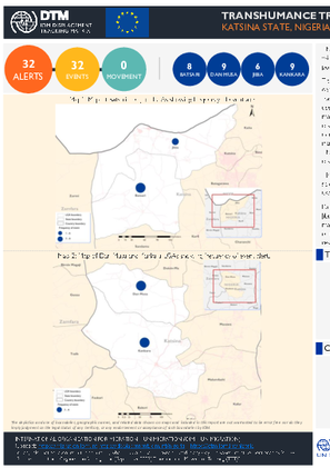
During the month of August 2023, the TTT Early Warning tool captured 32 alerts in Batsari, Dan Musa, Jibia and Kanakara LGAs of Katsina State. The triangulated alerts included 32 (100%) events, no (0%) massive/sudden movements were recorded during the period. The event alerts spread across 76 per cent of the wards in the four operational LGAs. Bugaje and Hurya wards located in Jibia and Kankara LGAs respectively, share the highest number of recorded event alerts. conflicts in these locations.
Contact
DTM Nigeria, iomnigeriadtm@iom.int
Language
English
Location
Nigeria
Period Covered
May 19 2023
May 23 2023
Activity
- Baseline Assessment
The transhumance baseline and infrastructure mapping is established as part of the monitoring of transhumant movements which often cause agro-pastoral conflicts that often result in loss of livestock/crops or even human lives. A transhumance data collection and information management system (Transhumance Tracking Tool, TTT) was initially established to analyze the transhumance data and to identify trends and patterns. The purpose of the mapping was to obtain baseline information on the transhumance corridors/stock routes (official and unofficial) as well as livestock passage points/areas. It seeks to map the areas of intervention and the localities where the counting activity would be carried out. The information was obtained through meetings with government authorities, field observation, partners and other key informants’ and was done along the transhumance corridors (stock routes).
The transhumance baseline and infrastructure mapping was conducted in Kachia and Kaura Local Government Areas (LGAs) of Kaduna State, and Faskari and Kaita LGAs of Katsina State, between 19 and 23 May 2023. The mapping was supported by members of the community, farmers association members, herders’ association members, and displacement tracking matrix (DTM) enumerators. This was the first phase of the TTT.
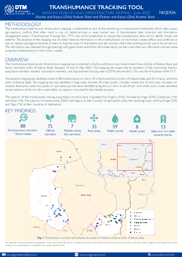
The baseline mapping has identified a total of 88 transhumance corridors, 45 in Kachia and Kaura LGAs of Kaduna State, and 43 in Faskari and Kaita LGAs of Katsina State. The mapping has also identified 7 large cattle markets, 59 water points, 2 fodder outlets and 35 rest areas. However, no livestock feed banks, veterinary posts, or vaccination portals were identified along the corridors. In the 69 per cent of the stock routes identified, certain sections of the corridors were either occupied or not used for the intended purpose.
The majority of the transhumants moving along these corridors were originated from Nigeria (71%), followed by Niger (27%), Cameroon (1%),
and Chad (1%). The majority of transhumants (92%) had Nigeria as their country of destination, while the remaining 8 per cent had Niger (7%)
and Togo (1%) as their countires of destination.
Contact
DTM Nigeria, iomnigeriadtm@iom.int
Language
English
Location
Nigeria
Period Covered
May 17 2023
May 27 2023
Activity
- Baseline Assessment
The transhumance baseline and infrastructure mapping is established as part of the monitoring of transhumant movements which often cause agro-pastoral conflicts that often result in loss of livestock/crops or even human lives. A transhumance data collection and information management system (Transhumance Tracking Tool, TTT) was initially established to analyze the transhumance data and to identify trends and patterns. The purpose of the mapping was to obtain baseline information on the transhumance corridors/stock routes (official and unofficial) as well as livestock passage points/areas. It seeks to map the areas of intervention and the localities where the counting activity would be carried out. The information was obtained through meetings with government authorities, field observation, partners and other key informants’ and was done along the transhumance corridors (stock routes).
The transhumance baseline and infrastructure mapping was conducted in Batsari, Dan musa, Jibia and Kankara LGAs of Katsina State, between 17 and 27 May 2023. The mapping was supported by members of the community, farmers association members, herders’ association members, and displacement tracking matrix (DTM) enumerators. This was the first phase of the TTT.
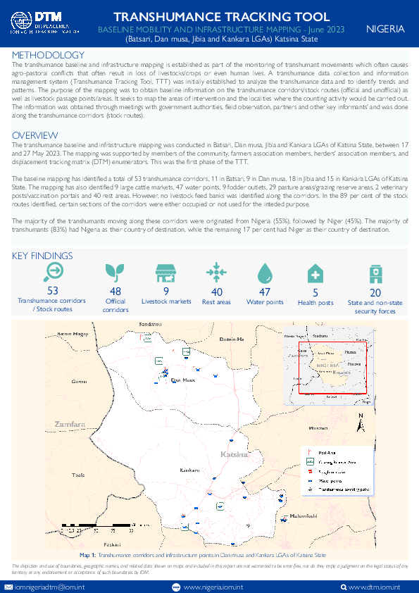
The baseline mapping has identified a total of 53 transhumance corridors, 11 in Batsari, 9 in Dan musa, 18 in Jibia and 15 in Kankara LGAs of Katsina State. The mapping has also identified 9 large cattle markets, 47 water points, 9 fodder outlets, 29 pasture areas/grazing reserve areas, 2 veterinary posts/vaccination portals and 40 rest areas. However, no livestock feed bank was identified along the corridors. In the 89 per cent of the stock routes identified, certain sections of the corridors were either occupied or not used for the intended purpose.
The majority of the transhumants moving along these corridors were originated from Nigeria (55%), followed by Niger (45%). The majority of
transhumants (83%) had Nigeria as their country of destination, while the remaining 17 per cent had Niger as their country of destination.
Contact
DTM South Sudan, SouthSudanDTM@iom.int
Language
English
Location
South Sudan
Period Covered
Mar 01 2023
Apr 30 2023
Activity
- Mobility Tracking
- Baseline Assessment
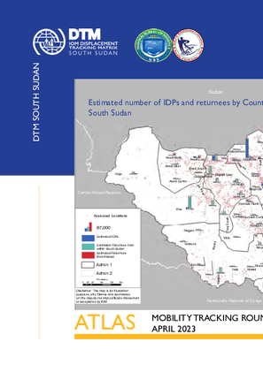
This atlas contains a summary of findings from the fourteenth round of Mobility Tracking conducted across South Sudan through key-informants based assessment at location level between March and April 2023. Mobility Tracking quantifies the presence of internally displaced persons (IDPs) and returnees in South Sudan in displacement sites and host communities. IOM DTM mapped a total of 2,027,331 IDPs (including 8% previously displaced abroad) and 2,335,604 returnees (including 27% from abroad) in 3,916 locations across South Sudan as of April 2023.
Contact
DTM Europe, DTMMediterranean@iom.int
Language
English
Location
Slovakia
Snapshot Date
Jun 30 2023
Activity
- Survey
- Return Intention
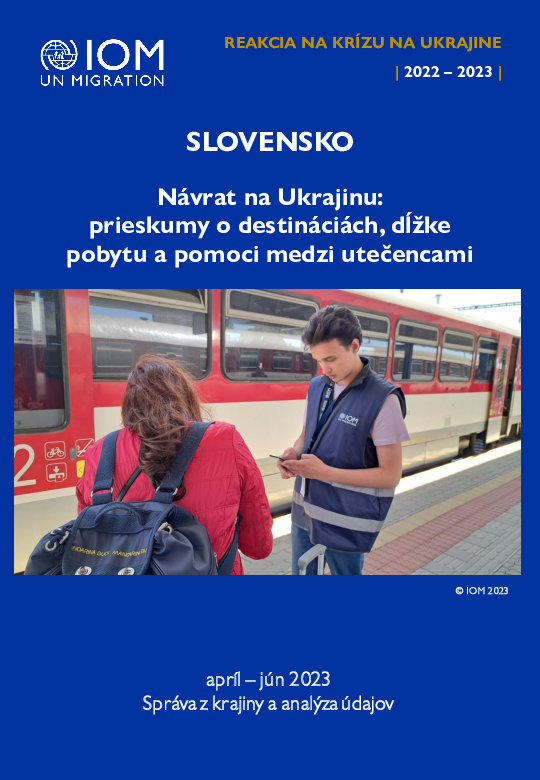
Utečenci z Ukrajiny a štátni príslušníci tretích krajín (ŠPTK) od 24. februára 2022 utekajú do susediacich krajín pred vojnou. K júlu 2023 bolo v Európe zaznamenaných takmer šesť miliónov utečencov. Okrem toho od februára 2022 prekročilo hranice Ukrajiny do susediacich krajín viac ako 20 miliónov utečencov a migrantov z Ukrajiny alebo tretích krajín.
IOM v polovici apríla 2022 nasadila svoj nástroj Displacement Tracking Matrix (DTM) určený na monitorovanie vysídlených osôb. Pomocou neho sa zbierajú údaje v prieskumoch jednotlivcov v krajinách susediacich s Ukrajinou pri tom, ako prekračujú hranicu späť na Ukrajinu. Jeho cieľom je zlepšiť pochopenie profilov, vzorcov vysídlenia, zámerov a potrieb tých, ktorí sa tam vracajú. Táto správa je založená na prieskumoch zozbieraných na Slovensku v období od 10. apríla do 30. júna 2023 v Bratislave a Košiciach na tranzitných bodoch (vlakových a autobusových staniciach) od osôb smerujúcich priamo na Ukrajinu.
Contact
DTMDRC@iom.int
Location
Democratic Republic of the Congo
Activity
- Mobility Tracking
- Baseline Assessment
Period Covered
Oct 20 2022 -Nov 12 2022
Depuis novembre 2021, les attaques de l’ex-groupe rebelle M23 ont repris et se sont multipliées contre les forces armées congolaises (FARDC) dans l’Est de la RDC. Ces affrontements se sont encore intensifiés depuis mars 2022, à la faveur desquels le M23 s'est emparé en juin 2022 de la ville de Bunagana, située à la frontière avec l'Ouganda, ainsi que d'autres localités voisines dans les régions de Jomba, Bweza, Kisigari et Busanza, en territoire de Rutshuru. Fin octobre 2022, les anciens rebelles du M23 ont étendu leur emprise après plusieurs offensives, élargissant leur contrôle sur l'ensemble de la chefferie de Bwisha, y compris la capitale du territoire et la ville de Kiwanja, avec des plans présumés d'extension sur l'ensemble du territoire. Dans le territoire de Rutshuru, ces attaques ont déplacé 234 488 personnes (40 027 ménages) depuis les zones de combat (groupements de Jomba, Bweza et Kisigari) vers des zones considérées comme sécurisées dans les territoires de Nyiragongo, Rutshuru et Lubero, notamment les zones de santé de Nyiragongo, Bambo, Kayna et Kibirizi.
Population Groups
Survey Methodology
Unit of Analysis Or Observation
Type of Survey or Assessment
Keywords
Geographical Scope
Administrative boundaries with available data
The current dataset covers the following administrative boundaries
