-
Countries
-
Data and Analysis
-
Special Focus
-
Crisis Responses
Internal displacement
Domain host
displacement.iom.int
Contact
DTM Yemen, iomyemendtm@iom.int
Language
English
Location
Yemen
Period Covered
May 19 2024
May 25 2024
Activity
- Rapid Emergency Registration
- Mobility Tracking
- Event Tracking
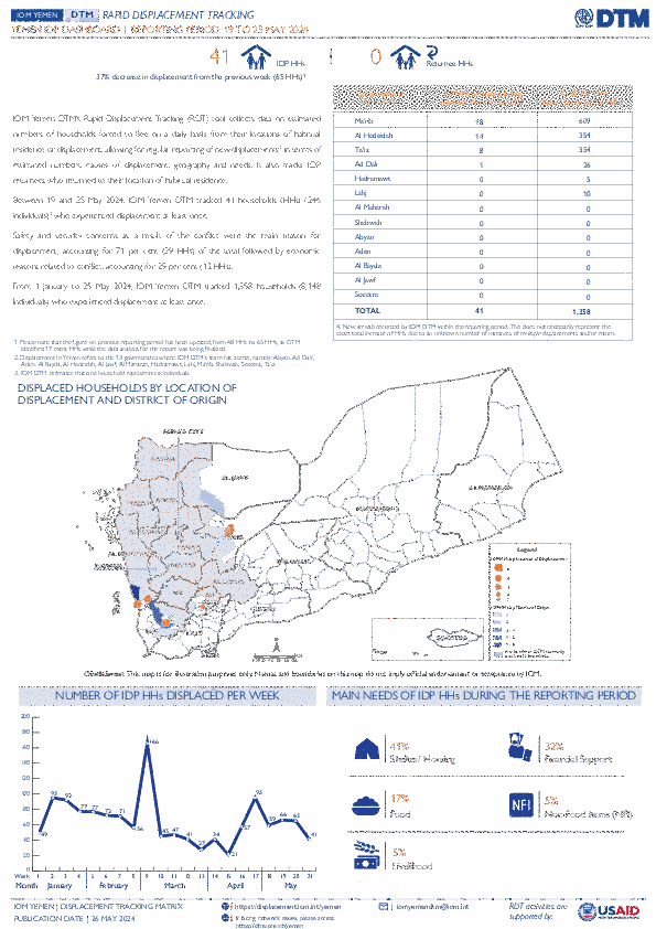
IOM Yemen DTM’s Rapid Displacement Tracking (RDT) tool collects data on estimated numbers of households forced to flee on a daily basis from their locations of origin or displacement, allowing for regular reporting of new displacements in terms of estimated numbers, geography, and needs. It also tracks returnees who returned to their location of origin.
From 1 January to 25 May 2024, IOM Yemen DTM tracked 1,358 households (HH) (8,148 Individuals) who experienced displacement at least once.
Between 19 and 25 May 2024, IOM Yemen DTM tracked 41 households (246 individuals) displaced at least once. The majority of people moved into/within the following governorates and districts:
- Ma’rib (18 HHs) – Ma’rib City (14 HHs), Ma’rib (4 HHs) districts. Most displacements in the governorate originated from Al Hodeidah and Al Jawf.
- Al Hodeidah (14 HHs) – Al Khukhah (8 HHs), Hays (6 HHs) districts. Most displacements in the governorate originated from Al Hodeidah and Ta’iz.
- Ta’iz (8 HHs) – Jabal Habashi (8 HHs) district. All displacements in the governorate were internal.
The majority of people moved from the following governorates and districts:
- Al Hodeidah (15 HHs) – At Tuhayta (9 HHs), Hays (3 HHs), Al Marawiah (1 HH) districts.
- Ta’iz (14 HHs) – Al Maafer (6 HHs), Maqbanah (5 HHs), Ash Shamayatayn (1 HH) districts.
- Al Jawf (2 HHs) – Al Hazm (2 HHs) district.
IOM identified 17 additional households displaced in the previous reporting period, which covered 12 - 18 May 2024, in the governorates of Al Hodeidah (8 HHs), Ma’rib (5 HHs), and Ta’iz (4 HHs). These figures have been added to the cumulative displacement total recorded since the beginning of the year.
Contact
DTM Somalia, IOMSomaliaDTM@iom.int
Language
English
Location
Somalia
Period Covered
May 11 2024
May 15 2024
Activity
- Mobility Tracking
- Baseline Assessment
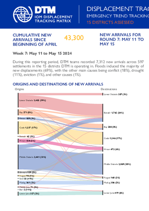
This latest round of Emergency Trends Tracking was initiated in April 2024 to monitor displacements movements during the Gu rainy season. Districts covered in this round include Afgooye, Afmadow, Baardheere, Baidoa, Balcad, Belet Weyne, Gaalkacyo, Garoowe, Jamaame, Jowhar, Kismaayo, and Luuq.
ETT is a crisis-based tool that tracks sudden displacement triggered by specific events or emerging crises. The objective of ETT is to help prioritize humanitarian response and to enable partners to deliver rapid assistance. Based on previous shock induced displacement patterns, the humanitarian community expects that people will continue to move toward urban areas in search of humanitarian services. Consequently, the ETT coverage focuses on the main urban centers and surrounding villages for each assessed district. The data is collected through Key Informant Interviews (KIIs) at the location level, from Sunday to Wednesday every week. It includes information on new arrivals, numbers and demographic of IDPs, reasons for displacement, intentions, humanitarian assistance and priority needs among others.

Contact
DTM Mozambique, DTMMozambique@iom.int
Language
English
Location
Mozambique
Period Covered
Dec 05 2023
May 29 2024
Activity
- Mobility Tracking
- Site Assessment
This Multi-Sectorial Location Assessment (MSLA) report, which presents findings from the International Organization for Migration’s (IOM) Displacement Tracking Matrix (DTM) Round 13 assessments, aims to enhance understanding of the extent of internal displacements and the needs of affected populations in conflict-affected and disaster-affected districts of Mozambique. Data was collected between 5 - 29 December 2023 in close coordination with provincial government and Instituto Nacional de Gestão e Redução do Risco de Desastres (INGD) partners, and presents trends from 190 assessed sites hosting internally displaced persons (IDPs) across Northern (Cabo Delgado 95 sites, Nampula 2 sites, Niassa 7 sites), Central Mozambique (Sofala 36 sites, Manica 35 sites, Zambezia 10 sites, Tete 3 sites) and Southern (Inhambane 2 sites).
A total of 317,224 (IDPs were reported present in all 190 sites assessed. This represents a reduction of 19 per cent from MSLA Round 12. Reported figures, however, exclude displaced individuals living in host community settings. According to DTM Round 20 Mobility Tracking Report, as of August, an estimated 709,529 were identified living in both host communities and sites (582,764 IDPs in Northern Mozambique, and 126,765 IDPs in Central Mozambique).
Contact
DTM South Sudan, SouthSudanDTM@iom.int
Language
English
Location
South Sudan
Period Covered
Mar 01 2024
Mar 31 2024
Activity
- Registration
- Flow Monitoring
- Mobility Tracking
- Site Assessment
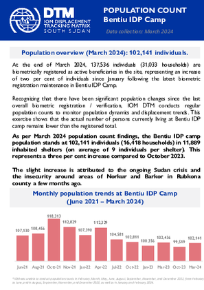
As per March 2024 population count findings, the Bentiu IDP camp population stands at 102,141 individuals (16,418 households) in 11,889 inhabited shelters (on average of 9 individuals per shelter). This represents a three per cent increase compared to October 2023.
Contact
DTM South Sudan, SouthSudanDTM@iom.int
Language
English
Location
South Sudan
Period Covered
Sep 14 2023
Oct 03 2023
Activity
- Mobility Tracking
- Site Assessment
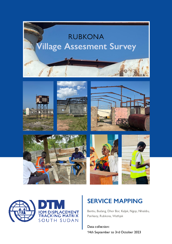
The data collection took place from September 14th, 2023, to October 3rd, 2023, covering a period of twenty days. The Displacement Tracking Matrix (DTM), a unit of the International Organization for Migration (IOM), conducted a 20-day Village Assessment Survey (VAS) in Rubkona County to assess transition and recovery needs. The survey focused on 09 Payam and 27 bomas accessible, as rainy season and flood limited access to some of the areas.
Of the 76 settlements assessed, 12 were found deserted while 64 remained populated. The survey meticulously mapped 240 facilities, 76 settlements, and 2 livelihood areas across the surveyed bomas. This includes 6 settlements in 6 bomas not assessed due to flooding. Among the 76-settlement identified, there are 37 neighborhoods, 30 permanent villages, 7 IDP sites and 2 temporary sites. The team managed to map 2 livelihood areas categorized into fishery grounds.
KEY FINDINGS
The assessment reveals a substantial number of destroyed or abandoned buildings, emphasizing the pressing need for housing reconstruction initiatives to address the housing crisis in the county.
Many areas within Rubkona County lack access to essential services such as education, healthcare, and markets, indicating a need for targeted interventions to improve service provision and overall community well-being.
In 67% of bomas, the fear of disasters, such as flooding, poses a substantial challenge for peaceful return, emphasizing the impact of environmental factors on human settlements.
A prevalent issue in multiple bomas across Rubkona County is the presence of individuals living on land/property without paying rent or obtaining permission from the owners, with 57% of bomas reporting such instances.
Most residential structures in Rubkona County lack permanency, characterized by the prevalence of temporary shelters such as tents and tukuls. These constructions are primarily composed of mud walls and thatched roofing, indicating a deficiency in durable and lasting housing infrastructure.
Critical need for improvements in school infrastructure, including insecure buildings, classroom shortages, insufficient furniture, and inadequate water and sanitation facilities, to create a conducive learning environment.
Urgent need for renovations, upgrades, and construction of permanent structures in healthcare facilities to ensure a safe environment for patients and healthcare workers.
The pressing need to rehabilitate non-operational boreholes to ensure a reliable water supply. the lack of water user committees in certain bomas inhibits local management of water resources.
Contact
DTM South Sudan, SouthSudanDTM@iom.int
Language
English
Location
South Sudan
Period Covered
Mar 09 2024
Mar 09 2024
Activity
- Survey
- Return Intention
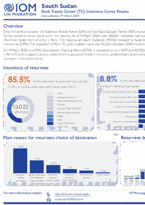
On 9 March 2024, the IOM’s Displacement Tracking Matrix (DTM), in collaboration with WFP and ACTED, conducted a rapid intention survey in Renk TC and its adjacent area to understand the population's return intentions, preferred destinations of return, as well as reasons for choosing to remain in the transit center.
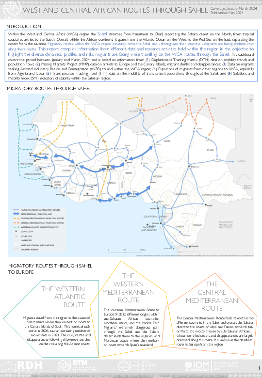
Within the West and Central Africa (WCA) region, the Sahel stretches from Mauritania to Chad, separating the Sahara desert on the North, from tropical coastal countries to the South. Overall, within the African continent, it spans from the Atlantic Ocean on the West to the Red Sea on the East, separating the desert from the savanna. Migratory routes within the WCA region inevitably cross the Sahel and - throughout their journeys - migrants are facing multiple risks along these routes.
This report compiles information from different data and research activities held within the region in the objective to highlight the diverse dynamics, profiles and risks migrants are facing while travelling on the WCA routes through the Sahel. This dashboard covers the period between January and March 2024 and is based on information from (1) Displacement Tracking Matrix (DTM) data on mobility trends and population flows; (2) Missing Migrants Project (MMP) data on arrivals to Europe and the Canary Islands, migrant deaths and disappearances; (3) Data on migrants seeking Assisted Voluntary Return and Reintegration (AVRR) to and within the WCA region; (4) Expulsions of migrants from other regions to WCA, especially from Algeria and Libya; (5) Transhumance Tracking Tool (TTT) data on the mobility of transhumant populations throughout the Sahel; and (6) Solutions and Mobility Index (SMI) indicators of stability within the Sahelian region.

Contact
DTMMozambique@iom.int
Language
English
Location
Mozambique
Period Covered
May 10 2024
May 21 2024
Activity
- Mobility Tracking
- Event Tracking
Between 10 to 21 May 2024, attacks, and fear of attacks by Non-state Armed Groups in Macomia and Quissanga triggered the cumulative displacement of 4,521 individuals/ 1,351 families. The current Movement Alert #114 reports on most recent attacks in Northen Cabo Delgado. For more information on displacements between January and April, please see {Emergency Tracking Online Dashboard}.
Contact
DTM Nigeria, iomnigeriadtm@iom.int
Language
English
Location
Nigeria
Period Covered
Jan 01 2023
Dec 31 2023
Activity
- Other
- Survey
- Flow Monitoring Survey
- Return Intention
- Registration
- Biometric Registration
- Flow Monitoring
- Mobility Tracking
- Site Assessment
- Event Tracking
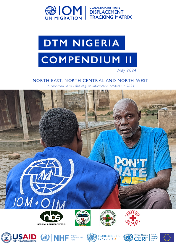
A collection of all DTM Nigeria information products in 2023.
Contact
DTM Nigeria, iomnigeriadtm@iom.int
Language
English
Location
Nigeria
Period Covered
Apr 01 2024
Apr 30 2024
Activity
- Other
Conflicts between farmers and herders in North-East Nigeria and other Sahel regions are rooted in many factors such as desertification, climate change impacts, low rainfall, and competition over suitable land for farming and transhumance activities. These issues are exacerbated by rapid population growth, which drives demand for food, shelter, and security for both humans and livestock. Consequently, competition for scarce natural resources intensifies, leading to incidents like farming on cattle routes, crop destruction, farm damage, and water pollution among others, which often escalate into violent confrontations between the farmer and herder communities.
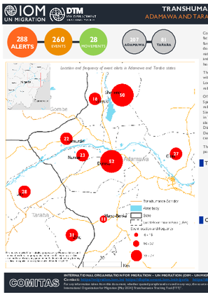
The Transhumance Tracking Tool (TTT) as a component of the IOM's Displacement Tracking Matrix (DTM), with the support of community key informants, operationalized the Early Warning System in the selected 9 Local Government Area (LGA) in the adjoining states of Adamawa and Taraba to collect alerts that are related to farmer-herder conflicts.
Of the 288 alerts recorded in April, 260 (90%) are event-related while 28 (10%) are related to movements. Specifically, Demsa, Girei, Lamurde, Numan and Shelleng LGAs in Adamawa state reported solely event-related alerts, while in Guyuk LGA, 89 per cent were event-related and 11 per cent were movement-related. Similarly, Mayo-belwa LGA reported 73 per cent event-related alerts and 27 per cent movement-related. Also in Taraba state, Lau LGA reported 74 per cent of event-related alerts and 26 per cent are movement-related alerts while Zing LGA reported 72 per cent of movement-related alerts and 28 per cent are event-related. Disaggregated ward-level data indicates that Kodompti, Talum and Demsa wards in Numan, Shelleng and Demsa LGAs of Adamawa state reported the highest percentage of events, cumulatively encompassing 20 per cent of the total alerts.
The event alerts reported across all LGAs suggested a population displacement rate of 2 per cent, with 17 per cent of instances of alerts resulting in casualties or injuries.
Pagination
- Previous page
- Page 79
- Next page
