
IDPs — Reasons for displacement (Natural Disasters)
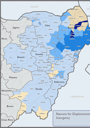
IDPs — Reasons for displacement (Insurgency)
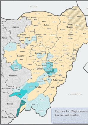
IDPs — Reasons for displacement (Communal Clashes)
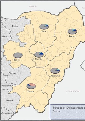
IDPs per period of displacement at the State level.
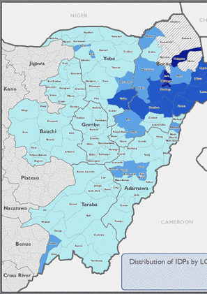
Distribution of IDPs by LGA.

Distribution of Return locations.

Distribution of IDP locations.

Estimated number of IDPs and Returnees by State.
- Mobility Tracking
- Baseline Assessment
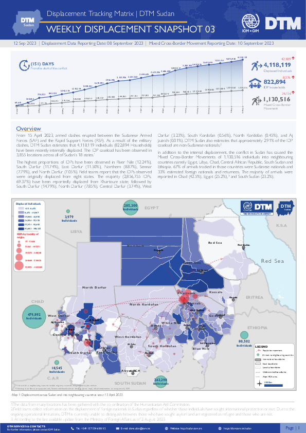
Overview
From 15 April 2023, armed clashes erupted between the Sudanese Armed Forces (SAF) and the Rapid Support Forces (RSF) in multiple cities across Sudan. Clashes initially took place in cities across Northern and Khartoum states, later spreading across the Darfur and Kordofan regions.
Highlights
- DTM Sudan estimates that 4,118,119 Individuals (822,894 Households) have been recently internally displaced.
- The IDP caseload has been observed in in 3,855 locations across all of Sudan’s 18 states.
- The highest proportions of IDPs have been observed in River Nile (12.24%), South Darfur (11.74%), East Darfur (11.50%), Northern (8.87%), Sennar (7.79%), and North Darfur (7.05%).
- Field teams report that the IDPs observed were originally displaced from eight states. The majority (2,856,755 IDPs, 69.37%) have been reportedly displaced from Khartoum state; followed by South Darfur (14.79%), North Darfur (7.85%), Central Darfur (3.74%), West Darfur (3.23%), South Kordofan (0.56%), North Kordofan (0.45%), and Aj Jazirah (0.01%).
- DTM also reports the Mixed Cross-Border Movements of 1,130,516 individuals into neighbouring countries.
- Mobility Tracking
- Site Assessment
Feb 04 2023
Population Groups
Survey Methodology
Unit of Analysis Or Observation
Type of Survey or Assessment
Keywords
Geographical Scope
Administrative boundaries with available data
The current dataset covers the following administrative boundaries

DTM API
Making global IDPs data accessible and reliable
The Displacement Tracking Matrix application programming interface (API) accelerates secure sharing of IDPs’ data, simplifying access to data across users and partners to support action, insight and foresight.