Papua New Guinea Country monitoring
Countries in this response
- Active DTM operation
- Past DTM operation
Check out the interactive dashboard
Papua New Guinea Dashboard![]()
Pari Andawale community in Tebi LLG: This community was affected by conflict on 11 April 2022. About 70 homes were burnt down and an estimated 1,200 displaced. The IDPs fled to different villages around Hela.
Pari / Andawale community, Tepi LLG: On 11-Apr-2022, a fight broke out displacing an estimated 500 people from three council wards. At least 60 houses were burnt down, and livestock, food gardens, and trees were destroyed.
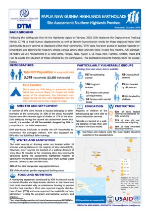
Following the earthquake that hit the Highlands region in February 2018, IOM deployed the Displacement Tracking Matrix (DTM) to track human displacements, as well as identify humanitarian needs for those displaced from their community to care centres or displaced within their community. DTM
Following a 7.5 magnitude earthquake which hit the Highlands Region of Papua New Guinea (PNG) and affected an estimated 544,000 people in five provinces1, assessment teams visited 38 displacement sites2 in the Hela, Southern Highlands and Western Provinces of PNG between 10 – 27 March 2018.

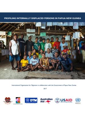
This profiling report presents the findings of a survey conducted in provinces hosting internally displaced persons (IDPs) in Papua New Guinea (PNG).
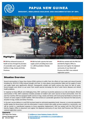
During the reporting period IOM enhanced the recovery of health services through the provision of sustainable water supply at health facilities in Enga, Jiwaka and Simbu Provinces. IOM also built a gravity-fed water supply system providing clean water to 1,200 households in Morobe Province.
This map is an annex to the report entitled “Internal displacements induced by natural and man-made hazards in Papua New Guinea (November 2016)”. It displays type and magnitude of displacement across Papua New Guinea as of November 2016.
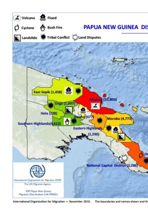
Throughout the last decade, Papua New Guinea (PNG) has experienced internal displacements arising in the context of natural and human induced hazards that includes the Manam volcano and tribal conflicts respectively.
Papua New Guinea - Site Assessment - Earthquake 2018 - Round 3
May 30 2018
A site assessment is a sub-component of mobility tracking. It aims to collect data on population presence, living conditions and needs in a particular displacement site or community.
Papua New Guinea - Site Assessment - Earthquake 2018 - Round 2
Apr 30 2018
A site assessment is a sub-component of mobility tracking. It aims to collect data on population presence, living conditions and needs in a particular displacement site or community.
Papua New Guinea - Baseline - Round 1
Oct 31 2016
A baseline assessment is a sub-component of mobility tracking. It aims to collect data on IDP, migrant or returnee population presence in a defined administrative area of the country.

DTM API
Making global IDPs data accessible and reliable
The Displacement Tracking Matrix application programming interface (API) accelerates secure sharing of IDPs’ data, simplifying access to data across users and partners to support action, insight and foresight.