-
Countries
-
Data and Analysis
-
Special Focus
-
Crisis Responses
Contact
ISSDTM@iom.int; dhilaire@iom.int
Location
South Sudan
Activity
- Mobility Tracking
Period Covered
Jan 01 2021 -Dec 31 2021
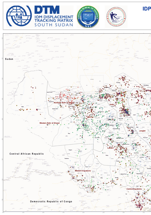
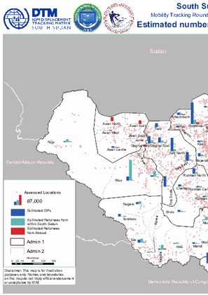
IOM DTM employs Event Tracking as a more rapid and localized assessment tool complementing overall efforts to report on IDP and returnee figures nationally. IOM teams access IDP/returnee locations and consult local key informants including community representatives, local authorities or humanitarian partners and triangulate findings to provide partners with the most accurate as possible, actionable and current data.
Population Groups
Survey Methodology
Unit of Analysis Or Observation
Type of Survey or Assessment
Keywords
Geographical Scope
Administrative boundaries with available data
The current dataset covers the following administrative boundaries
Contact
DTM South Sudan, SouthSudanDTM@iom.int
Language
English
Location
South Sudan
Period Covered
Nov 05 2020
Jun 02 2021
Activity
- Other
- Survey
- Biometric Registration
- Verification for Registration
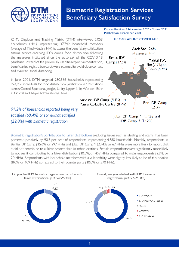
IOM’s Displacement Tracking Matrix (DTM) interviewed 5,059 households (HHs) representing 37,792 household members (average of 7 individuals / HH) to assess the beneficiary satisfaction among service-receiving IDPs during food distribution following the measures instituted since the outbreak of the COVID-19 pandemic. Instead of the previously used fingerprint authentication, beneficiaries’ registration cards were scanned to avoid close contact and maintain social distancing.
In June 2021, DTM targeted 250,566 households representing 974,956 individuals for food distribution verification in 19 locations across Central Equatoria, Jonglei, Unity, Upper Nile, Western Bahr el Ghazal and Abyei Administrative Area.

Contact
DTMcovid19@iom.int
Language
English
Location
Global
Snapshot Date
Dec 13 2021
Activity
- Other
The current outbreak of COVID-19 has affected global mobility in the form of various travel disruptions and restrictions. To better understand how COVID-19 affects global mobility, DTM has developed a COVID-19 database mapping the different restrictions to provide a global overview. For this, DTM uses the IATA site as the primary source of restrictions with the information reported per country and territory, and to the country of application.
Data collected includes:
- Date of restriction
- Country, territory or area of restriction
- Countries, territories or areas on which restrictions were imposed
- Type of restriction- total restriction, or conditional restriction – such as medical/ and or visa restriction
This DTM COVID-19 Travel Restrictions Output presents an analysis based on country imposing, the country being imposed upon, and the aggregation of the restriction type. The aim of the data analysis is to provide an overview of the COVID-19 outbreak on global mobility and to help identify and develop responses.
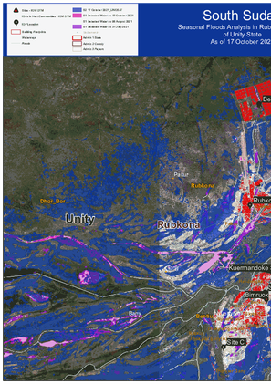
Seasonal Floods Analysis in Bentiu / Rubkona Town, Rubkona County of Unity State as of 17 October 2021.

Contact
DTM Guinée, oimguineedtm@iom.int
Language
French
Location
Guinea
Period Covered
Nov 01 2021
Nov 30 2021
Activity
- Flow Monitoring
Le suivi des flux de population (Flow Monitoring, FM) est un exercice qui vise à identifier les zones de forte mobilité interne et transfrontalière à fin de mieux comprendre les caractéristiques des flux migratoires.
Ce rapport présente les données obtenues pendant le mois de Novembre 2021 au niveau des FMPs de Boundou-fourdou dans la préfecture de Koundara au Nord du pays et de Kourémale dans la préfecture de Siguiri au Nord-Est de la Guinée. Ces données sont collectées lors de l’enregistrement des flux effectués auprès des voyageurs.
