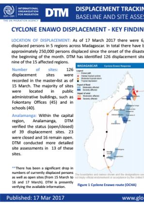
Cyclone Enawo
Pays dans cette réponse
- Active DTM operation
- Past DTM operation
This map provides an overview of the displacement sites set up in Madagascar as well as the number of displaced persons per region, following the impact of Cyclone Enawo.
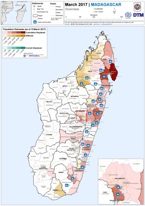
This map provides an overview of the regions most affected by displacement as of 15 March 2017, following the impact of Cyclone Enawo.
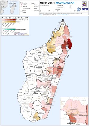
This map provides an overview of the regions in Madagascar that are most affected by displacement, following the impact of Cyclone Enawo.

As of 17 March 2017 there were 6,334 displaced persons in 5 regions across Madagascar. In total there have been approximately 250,000 persons displaced since the onset of the disaster at the beginning of the month.
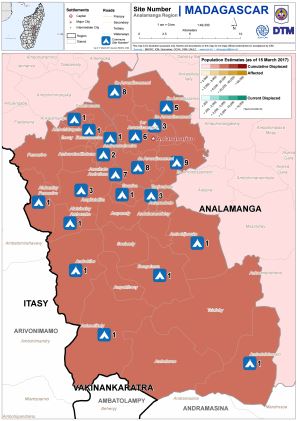
This map provides an overview of the displacement sites in Madagascar's region of Analamanga, as of 17 March 2017.
This map provides an overview of the regions in Madagascar that are most affected by displacement, following the impact of Cyclone Enawo, as of 17 March 2017.


DTM API
Making global IDPs data accessible and reliable
The Displacement Tracking Matrix application programming interface (API) accelerates secure sharing of IDPs’ data, simplifying access to data across users and partners to support action, insight and foresight.