-
Countries
-
Data and Analysis
-
Special Focus
-
Crisis Responses
South Sudan — Wau Infrastructure And Services Atlas (December 2019)

Contacter
DTM South Sudan, SouthSudanDTM@iom.int
Langue
English
Emplacement
South Sudan
Période couverte
Aug 01 2019
Nov 30 2019
Activité
- Mobility Tracking
- Site Assessment
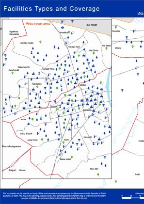
This atlas contains 17 individual maps as part of the Wau, Rubkona And Bor South Village Assessment Survey (August - November 2019). DTM mapped the presence and quality of available facilities, infrastructure and services:
- Facilities Types and Coverage
- Education Facilities by Functionality
- School Curriculum
- Healthcare Facilities by Functionality
- Improved Water Point Facilities
- Access to Water and Related Conflict
- Access to Water Sources
- Most Common Forms of Sanitation Practices
- Most Common Shelter Types
- Major Livelihood Practices
- Top Three Livelihood Shocks
- Land Ownerships and Land Allocations to returnees
- Challenges that Affect Farming
- Access to Major Markets
- External Threats, Violations and Risks
- Internal Threats, Violations and Risks
- Presence of Mines and Demining Activities
