South Sudan — Bor South Infrastructure and Services Atlas (December 2019)
Contacto
DTM South Sudan, SouthSudanDTM@iom.int
Idioma
English
Ubicación
South Sudan
Fecha de instantánea
Aug 01 2019
Nov 30 2019
Actividad
- Mobility Tracking
- Site Assessment
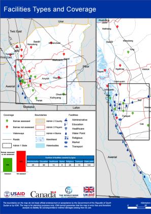
This atlas contains 17 individual maps as part of the Wau, Rubkona And Bor South Village Assessment Survey (August - November 2019). DTM mapped the presence and quality of available facilities, infrastructure and services:
- Facilities Types and Coverage
- Education Facilities by Functionality
- School Curriculum
- Healthcare Facilities by Functionality
- Improved Water Point Facilities
- Access to Water and Related Conflict
- Access to Water Sources
- Most Common Forms of Sanitation Practices
- Most Common Shelter Types
- Major Livelihood Practices
- Top Three Livelihood Shocks
- Land Ownerships and Land Allocations to returnees
- Challenges that Affect Farming
- Access to Major Markets
- External Threats, Violations and Risks
- Internal Threats, Violations and Risks
- Presence of Mines and Demining Activities

DTM Global Survey 2023
The Displacement Tracking Matrix (DTM) Global Survey 2023 is an annual stocktaking exercise which aims to present IOM DTM's operations and activities transparently. The Global Survey focuses on operations active from January 1 to December 31, 2023, with data collection occurring from February to April 2024.