-
Countries
-
Data and Analysis
-
Special Focus
-
Crisis Responses
Site Assessment

Contact
DTM South Sudan, SouthSudanDTM@iom.int
Language
English
Location
South Sudan
Period Covered
Apr 04 2022
May 17 2022
Activity
- Mobility Tracking
- Site Assessment
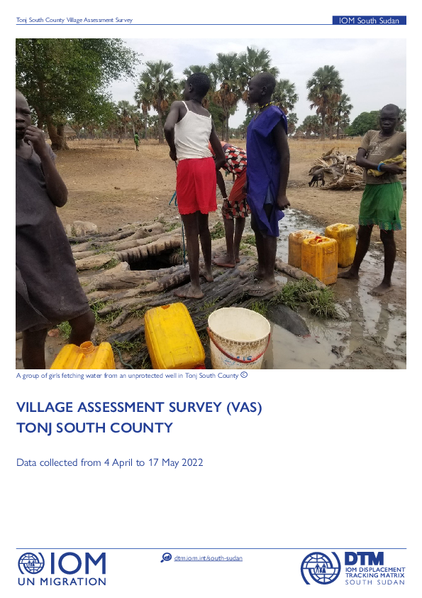
This Tonj South Village Assessment Survey covers a period from 4 April to 17 May 2022. Notably, it was found that 94% of administrative buildings, 90% of religious buildings, and 88% water points are functional. On the other hand, all of the assessed market facilities were found to be functional.

Contact
DTM South Sudan, SouthSudanDTM@iom.int
Language
English
Location
South Sudan
Period Covered
Mar 26 2021
Apr 30 2021
Activity
- Mobility Tracking
- Site Assessment
This Aweil South Village Assessment Survey covers a period from 26 March to 30 April 2021. Notably, it was found that 89% of education facilities are functional, and 72% of water points are functional. On the other hand, administrative buildings, health facilities, markets, religious facilities, and transport networks were all found to be functional.
Contact
iomkenyaPI@iom.int
Location
Kenya
Activity
- Mobility Tracking
- Site Assessment
- Baseline Assessment
Period Covered
Jan 16 2023 -Jan 28 2023
During this round, the data collection was conducted in 3 sub-counties of Samburu county in 16 wards across 110 sub-locations covering 686 settlements.
From 16 to 28 January 2023, the DTM team in Kenya has identified 7,879 returnees households, 9,736 arrival households, 4,772 returnee households and 15 foreign national households.
Population Groups
Survey Methodology
Unit of Analysis Or Observation
Type of Survey or Assessment
Keywords
Geographical Scope
Administrative boundaries with available data
The current dataset covers the following administrative boundaries

Contact
DTM South Sudan, SouthSudanDTM@iom.int
Language
English
Location
South Sudan
Period Covered
Jan 01 2023
Jan 31 2023
Activity
- Registration
- Flow Monitoring
- Mobility Tracking
- Site Assessment
As per January 2023 population count findings, the Bentiu Town Sites (A, B, C, D, and E) population stands at 63,022 individuals / 9,089 households (on average 6 individuals per household). This represents one per cent decrease (5,563 individuals/237 households) compared to October 2022.
Contact
DTM Nigeria, AllUsersInDTMNigeria@iom.int
Location
Nigeria
Activity
- Mobility Tracking
- Site Assessment
Period Covered
Sep 07 2022 -Nov 09 2022
2,100,180 returnees were recorded in the Round 43 assessment. This number represents an increase of 117,050 individuals or more than six per cent compared to Round 41 when 1,983,130 returnees were recorded in June 2022.
Population Groups
Survey Methodology
Unit of Analysis Or Observation
Type of Survey or Assessment
Keywords
Geographical Scope
Administrative boundaries with available data
The current dataset covers the following administrative boundaries
Contact
DTM Nigeria, AllUsersInDTMNigeria@iom.int
Location
Nigeria
Activity
- Mobility Tracking
- Site Assessment
Period Covered
Aug 01 2022 -Nov 19 2022
In Round 43, a total of 2,375,661 Internally Displaced Persons (IDPs) were identified in 483,467 households. This signifies a decrease of 3 per cent (or 79,529 individuals) compared to Round 42 when 2,455,190 IDPs were recorded (July 2022).
Population Groups
Survey Methodology
Unit of Analysis Or Observation
Type of Survey or Assessment
Keywords
Geographical Scope
Administrative boundaries with available data
The current dataset covers the following administrative boundaries
Contact
iomkenyaPI@iom.int
Location
Kenya
Activity
- Mobility Tracking
- Site Assessment
- Baseline Assessment
Period Covered
Nov 21 2022 -Dec 01 2022
The data collection was conducted across the entire nine sub-counties of Marsabit County in 19 Wards, 134 sub-locations and 1,045 settlements.
Population Groups
Survey Methodology
Unit of Analysis Or Observation
Type of Survey or Assessment
Keywords
Geographical Scope
Administrative boundaries with available data
The current dataset covers the following administrative boundaries
Contact
iomkenyaPI@iom.int
Location
Kenya
Activity
- Mobility Tracking
- Site Assessment
- Baseline Assessment
Period Covered
Nov 21 2022 -Dec 01 2022
The data collection was conducted across the entire three sub-counties of Isiolo County in 10 Wards, 88 sub-locations and 566 settlements.
Population Groups
Survey Methodology
Unit of Analysis Or Observation
Type of Survey or Assessment
Keywords
Geographical Scope
Administrative boundaries with available data
The current dataset covers the following administrative boundaries
Contact
iomkenyaPI@iom.int
Location
Kenya
Activity
- Mobility Tracking
- Site Assessment
- Baseline Assessment
Period Covered
Oct 17 2022 -Nov 12 2022
The assessment was conducted across the entire Turkana County by enumerators in 30 Wards, 174 sublocations and 1,867 settlements.
A total of 53 enumerators and five team leaders who are familiar with the local and administrative contexts were locally engaged from each sub-location, through the support of LOKADO. The local enumerators and team leaders were trained by IOM on DTM data collection prior to field deployment. The data collection process was implemented by LOKADO and closely monitored by IOM. The enumerators have accessed 163 sub-locations and carried out face-to-face interviews with the key informants. For the 11 sub-locations that were not accessible due to insecurity, data collection was conducted by interviewing
key informants over mobile phones. The assessment has excluded refugee camps in Kakuma to avoid double counting of affected mobile population. For the assessments, 571 key informants were interviewed covering a total of 1,867 settlements in Turkana County.
Population Groups
Survey Methodology
Unit of Analysis Or Observation
Type of Survey or Assessment
Keywords
Geographical Scope
Administrative boundaries with available data
The current dataset covers the following administrative boundaries
Contact
DTM Libya, DTMLibya@iom.int
Language
English
Location
Libya
Snapshot Date
Feb 28 2023
Activity
- Mobility Tracking
- Site Assessment
Detention Centre Profiling is a component of IOM Libya’s Displacement Matrix programme. It is a data oriented tool that routinely provides specific sex and age demographic data and key sectorial information on individuals held in Libya’s detention centres on the date of assessment.
Pagination
- Previous page
- Page 28
- Next page
